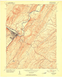
1951 Map of Keyser
USGS Topo · Published 1951About this map
Keyser serves as a critical hub on this 1951 survey, where the North Branch Potomac River carves a path through the dramatic ridgelines of Dans Mountain and New Creek Mountain. The town's layout reflects its dual identity as an educational center, anchored by Potomac State College, and a vital industrial crossing for both the Baltimore and Ohio and Western Maryland railroads. The valley floor near McCoole and Queens Point shows a landscape defined by rail infrastructure and river bends, while the surrounding uplands are dotted with small rural landmarks.
Find a feature on this map
56 named features on this map. Tap any name to fly to it.
Don’t see what you’re looking for? This feature index may not catch every label — zoom into the map to look around manually.
Map Details
Editions of this 1951 Keyser Map
This is the sole edition of this map. No revisions or reprints were ever made.
Other maps of this area

1891 · Romney
USGS Topo · 1:125,000

1895 · Piedmont
USGS Topo · 1:125,000

1898 · Frostburg
USGS Topo · 1:62,500

1899 · Grantsville
USGS Topo · 1:62,500

1901 · Frostburg
USGS Topo · 1:62,500

1904 · Grantsville
USGS Topo · 1:62,500

1908 · Frostburg
USGS Topo · 1:62,500

1919 · Elk Garden
USGS Topo · 1:48,000

1920 · Elk Garden
USGS Topo · 1:48,000

1920 · Keyser
USGS Topo · 1:62,500