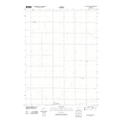
2010 Map of Keystone North
USGS Topo · Published 2010About this map
Keystone serves as the primary hub at the southern edge of this landscape, situated in the fertile agricultural plains of Benton County. The map documents a highly structured rural environment defined by a rigid grid of local thoroughfares such as 15th Ave and 66th St, reflecting the persistent logic of the Public Land Survey System. These roads connect isolated homesteads and smaller clusters like Rogersville to the north, which sits along the upper reaches of local drainage systems.
Find a feature on this map
22 named features on this map. Tap any name to fly to it.
Don’t see what you’re looking for? This feature index may not catch every label — zoom into the map to look around manually.
Map Details
Editions of this 2010 Keystone North Map
This is the sole edition of this map. No revisions or reprints were ever made.
Other maps of this area

1954 · Waterloo
USGS Topo · 1:250,000

1954 · Des Moines
USGS Topo · 1:250,000

1955 · Waterloo
USGS Topo · 1:250,000

1956 · Des Moines
USGS Topo · 1:250,000

1957 · Des Moines
USGS Topo · 1:250,000

1965 · Keystone South
USGS Topo · 1:24,000
1965 · Blairstown
USGS Topo · 1:24,000

1968 · Belle Plaine
USGS Topo · 1:24,000

1969 · Des Moines
USGS Topo · 1:250,000
1971 · Elberon
USGS Topo · 1:24,000