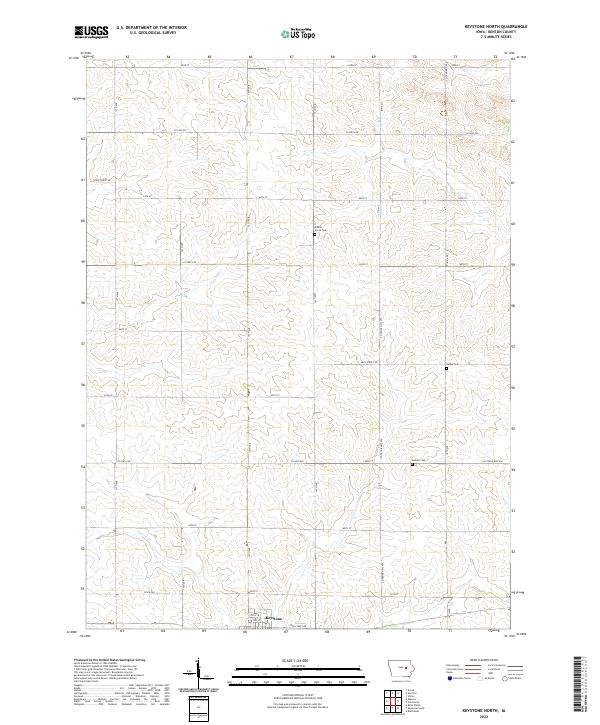
2022 Map of Keystone North
USGS Topo · Published 2022About this map
Keystone serves as the primary settlement anchor at the southern edge of this landscape, where the local road network of 3rd St and 4th St meets the rural agricultural sections of Benton County. The terrain is defined by the winding path of Prairie Cr, which carves through a systematic grid of section lines and county highways. For those tracing family histories or early land use, the map preserves the exact locations of several local burial grounds, including Bishop Grove Cem, LaRue Cem, and Bender Cem. These small rural cemeteries are often the last physical markers of early township communities. The infrastructure is characterized by a dense network of county routes, such as Co Hwy E30 and Co Hwy E40, which provided the essential corridors for Iowa's agrarian economy during the early 21st century.
Find a feature on this map
29 named features on this map. Tap any name to fly to it.
Don’t see what you’re looking for? This feature index may not catch every label — zoom into the map to look around manually.
Map Details
Editions of this 2022 Keystone North Map
This is the sole edition of this map. No revisions or reprints were ever made.
Other maps of this area

1954 · Waterloo
USGS Topo · 1:250,000

1954 · Des Moines
USGS Topo · 1:250,000

1955 · Waterloo
USGS Topo · 1:250,000

1956 · Des Moines
USGS Topo · 1:250,000

1957 · Des Moines
USGS Topo · 1:250,000

1965 · Keystone South
USGS Topo · 1:24,000
1965 · Blairstown
USGS Topo · 1:24,000

1968 · Belle Plaine
USGS Topo · 1:24,000

1969 · Des Moines
USGS Topo · 1:250,000
1971 · Elberon
USGS Topo · 1:24,000