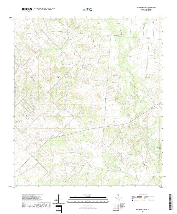
2022 Map of Keystone Ranch
USGS Topo · Published 2022About this map
San Miguel Cr and its various tributaries, including Black Cr and Cat Cr, define the drainage patterns of this Frio County landscape. The area is characterized by an extensive network of ranch and county roads, such as Co RD 3300 and Keystone Rd, which link remote ranching properties and homesteads. The terrain rises to the Marshall Hills in the southeast, while Howard Lake provides a significant water feature in the northern portion of the quadrangle. This 2022 survey illustrates the modern layout of rural infrastructure, tracing numerous family-named routes like Heiser Ln that intersect the brushy plains of South Texas. The map also captures the paths of Hackberry Cr and Live Oak Cr, showing how water management remains central to the region's agricultural layout.
Find a feature on this map
23 named features on this map. Tap any name to fly to it.
Don’t see what you’re looking for? This feature index may not catch every label — zoom into the map to look around manually.
Map Details
Editions of this 2022 Keystone Ranch Map
This is the sole edition of this map. No revisions or reprints were ever made.
Other maps of this area

1927 · Pearsall
USGS Topo · 1:62,500

1934 · Schattel
USGS Topo · 1:62,500

1942 · Dilley
USGS Topo · 1:62,500

1953 · Crystal City
USGS Topo · 1:250,000

1955 · Crystal City
USGS Topo · 1:250,000

1956 · Hindes
USGS Topo · 1:62,500

1961 · Crystal City
USGS Topo · 1:250,000

1964 · Pearsall South
USGS Topo · 1:24,000
1964 · Pearsall North
USGS Topo · 1:24,000

1968 · Crystal City
USGS Topo · 1:250,000