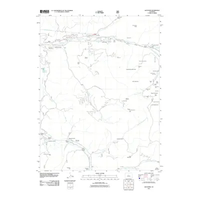
2011 Map of Keystone
USGS Topo · Published 2011About this map
Mining heritage and alpine recreation intersect in this high-altitude landscape of Summit County, Colorado. The community of Keystone serves as a modern hub at the confluence of Snake River and Keystone Gulch, where contemporary infrastructure like the Keystone Ski Area sits atop a dense network of historical claims. To the east and south, the terrain climbs toward Porcupine Peak and Independence Mountain, areas heavily marked by the region's extraction history. Dozens of named operations including the Saint Johns Mines, Aladdin Mine, and Royal Tiger Group Mine indicate the intensity of early 20th-century prospecting. Substantial civil engineering is evident in the Harold D Roberts Tunnel cutting through the mountains, while the drainage of Saints John Creek and North Fork Swan River highlights the complex water management required in this mineral-rich environment.
Find a feature on this map
110 named features on this map. Tap any name to fly to it.
Don’t see what you’re looking for? This feature index may not catch every label — zoom into the map to look around manually.
Map Details
Editions of this 2011 Keystone Map
This is the sole edition of this map. No revisions or reprints were ever made.
Other maps of this area

1889 · Leadville
USGS Topo · 1:125,000

1891 · Leadville
USGS Topo · 1:125,000

1924 · Montezuma
USGS Topo · 1:62,500

1926 · Montezuma
USGS Topo · 1:62,500

1929 · Dillon
USGS Topo · 1:62,500

1933 · Montezuma
USGS Topo · 1:62,500

1934 · Climax
USGS Topo · 1:48,000

1934 · Dillon
USGS Topo · 1:62,500

1937 · Como
USGS Topo · 1:62,500

1938 · Mt. Lincoln
USGS Topo · 1:48,000