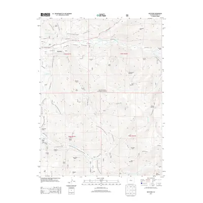
2013 Map of Keystone
USGS Topo · Published 2013About this map
Keystone serves as the focal point for this high-altitude landscape, where the recreation-heavy footprint of the Keystone Ski Area meets the industrial legacies of Summit County's mining past. The terrain is defined by a dense network of gulches and ridges, including Tenderfoot Mountain and Porcupine Peak, which feed the Snake River and Swan River systems. Hidden beneath these peaks, the Harold D Roberts Tunnel represents a massive feat of water engineering, diverting Western Slope water toward the Front Range. Local history is etched into the names of routes and landmarks such as the Hunkidori Mine Trail, Brewery Hill, and the settlement at Tiger. The presence of the Continental Divide National Scenic Trail underscores the area's role as a major alpine thoroughfare, while dozens of specialized trails like the Summit Fat Tire Society Trail reflect its modern evolution into a premier outdoor destination.
Find a feature on this map
61 named features on this map. Tap any name to fly to it.
Don’t see what you’re looking for? This feature index may not catch every label — zoom into the map to look around manually.
Map Details
Editions of this 2013 Keystone Map
This is the sole edition of this map. No revisions or reprints were ever made.
Other maps of this area

1889 · Leadville
USGS Topo · 1:125,000

1891 · Leadville
USGS Topo · 1:125,000

1924 · Montezuma
USGS Topo · 1:62,500

1926 · Montezuma
USGS Topo · 1:62,500

1929 · Dillon
USGS Topo · 1:62,500

1933 · Montezuma
USGS Topo · 1:62,500

1934 · Climax
USGS Topo · 1:48,000

1934 · Dillon
USGS Topo · 1:62,500

1937 · Como
USGS Topo · 1:62,500

1938 · Mt. Lincoln
USGS Topo · 1:48,000