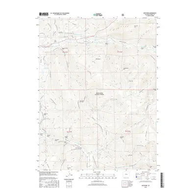
2016 Map of Keystone
USGS Topo · Published 2016About this map
Keystone serves as the central hub of this mountain landscape, which is defined by a dense network of recreational paths and infrastructure engineered for water diversion. The massive Harold D Roberts Tunnel cuts through the northern terrain, a significant feat of civil engineering designed to carry water under the Continental Mountains. While the modern Keystone Ski Area and Frisco - Keystone Bikepath indicate the region's contemporary use, older industrial traces remain in the landscape, such as the Soda Mine and the Hunkidori Mine Trail. The southern portion of the map is dominated by the headwaters of the Swan River and its various branches, including the N Swan River and Fork Swan River, which carve through deep gulches like Galena Gulch and Garibaldi Gulch. This 2016 survey illustrates the layered history of the area, from early prospecting at Brewery Hill to its current role within the White River National Forest.
Find a feature on this map
73 named features on this map. Tap any name to fly to it.
Don’t see what you’re looking for? This feature index may not catch every label — zoom into the map to look around manually.
Map Details
Editions of this 2016 Keystone Map
This is the sole edition of this map. No revisions or reprints were ever made.
Other maps of this area

1889 · Leadville
USGS Topo · 1:125,000

1891 · Leadville
USGS Topo · 1:125,000

1924 · Montezuma
USGS Topo · 1:62,500

1926 · Montezuma
USGS Topo · 1:62,500

1929 · Dillon
USGS Topo · 1:62,500

1933 · Montezuma
USGS Topo · 1:62,500

1934 · Climax
USGS Topo · 1:48,000

1934 · Dillon
USGS Topo · 1:62,500

1937 · Como
USGS Topo · 1:62,500

1938 · Mt. Lincoln
USGS Topo · 1:48,000