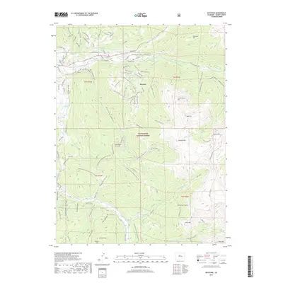
2019 Map of Keystone
USGS Topo · Published 2019About this map
Keystone and the high peaks of the White River National Forest define this landscape, where recreation and historical mining infrastructure meet. The Snake River and its numerous tributaries, including Muggins Gulch and Jones Gulch, drain a complex topography of summits such as Independence Mtn and Bear Mtn. The map highlights an extensive network of trails, from the Continental Divide National Scenic Trail to localized paths like Let it Ride Trail and Sanitarium Trail within the Keystone Ski Area. Evidence of the region's industrial past is visible in labels for the Soda Mine and the Galena Ditch, alongside modern water management features like the Harold D Roberts Tunnel and the Keystone Aqueduct. Numerous peaks, including Glacier Mtn and Wise Mtn, mark the high ridgelines that divide the various forks of the Swan River.
Find a feature on this map
93 named features on this map. Tap any name to fly to it.
Don’t see what you’re looking for? This feature index may not catch every label — zoom into the map to look around manually.
Map Details
Editions of this 2019 Keystone Map
This is the sole edition of this map. No revisions or reprints were ever made.
Other maps of this area

1889 · Leadville
USGS Topo · 1:125,000

1891 · Leadville
USGS Topo · 1:125,000

1924 · Montezuma
USGS Topo · 1:62,500

1926 · Montezuma
USGS Topo · 1:62,500

1929 · Dillon
USGS Topo · 1:62,500

1933 · Montezuma
USGS Topo · 1:62,500

1934 · Climax
USGS Topo · 1:48,000

1934 · Dillon
USGS Topo · 1:62,500

1937 · Como
USGS Topo · 1:62,500

1938 · Mt. Lincoln
USGS Topo · 1:48,000