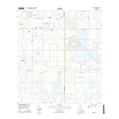
2015 Map of Keysville
USGS Topo · Published 2015About this map
Keysville and the surrounding ranchlands along the Hillsborough Co Polk Co line define this landscape at the intersection of agriculture and heavy industry. The drainage of the S Prong Alafia River and its various branches, including Mizelle Cr and Boggy Br, creates a complex hydrology that has been heavily modified by large-scale mining excavations and settling ponds. These industrial sites, particularly prominent east of Welcome, contrast with the smaller residential enclaves and family-named agricultural operations like Jameson Farms and Rogers Ranch. For those researching local families, the map identifies specific points of interest such as Blue Cem near the settlement of Edge and Hunter Cem located just west of Hunters Hill. The road network, including Lithia Pinecrest Rd and CR-640, serves as the primary artery connecting these scattered communities and industrial areas.
Find a feature on this map
60 named features on this map. Tap any name to fly to it.
Don’t see what you’re looking for? This feature index may not catch every label — zoom into the map to look around manually.
Map Details
Editions of this 2015 Keysville Map
This is the sole edition of this map. No revisions or reprints were ever made.
Other maps of this area

1949 · Mulberry
USGS Topo · 1:24,000

1949 · Bradley Junction
USGS Topo · 1:24,000

1950 · Mulberry
USGS Topo · 1:24,000

1950 · Bradley Junction
USGS Topo · 1:24,000

1955 · Lithia
USGS Topo · 1:24,000

1955 · Nichols
USGS Topo · 1:24,000

1955 · Dover
USGS Topo · 1:24,000

1955 · Baird
USGS Topo · 1:24,000

1955 · Keysville
USGS Topo · 1:24,000

1956 · Ft Lonesome
USGS Topo · 1:24,000