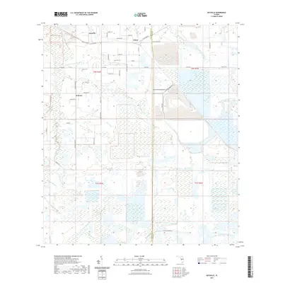
2021 Map of Keysville
USGS Topo · Published 2021About this map
The S Prong Alafia River and its numerous tributaries, including Thirtymile Creek and Mizelle Cr, define this central Florida landscape along the border of Hillsborough and Polk Counties. Small agricultural and residential clusters are centered around Keysville, Edison, and Welcome, with a network of rural roads such as Co RD 640 and Beulah Church Rd connecting the dispersed homesteads. Large-scale earthworks and reservoirs dominate the central and eastern sections, indicating significant industrial land use that contrasts with the wooded corridors of the Alafia River Corridor Trl. For genealogists, the map preserves the location of family-named landmarks like Hunter Cem and Blue Cem, alongside numerous family-named roads including Purvis Rd, Albritton Rd, and Virgil Hall Rd.
Find a feature on this map
52 named features on this map. Tap any name to fly to it.
Don’t see what you’re looking for? This feature index may not catch every label — zoom into the map to look around manually.
Map Details
Editions of this 2021 Keysville Map
This is the sole edition of this map. No revisions or reprints were ever made.
Other maps of this area

1949 · Mulberry
USGS Topo · 1:24,000

1949 · Bradley Junction
USGS Topo · 1:24,000

1950 · Mulberry
USGS Topo · 1:24,000

1950 · Bradley Junction
USGS Topo · 1:24,000

1955 · Lithia
USGS Topo · 1:24,000

1955 · Nichols
USGS Topo · 1:24,000

1955 · Dover
USGS Topo · 1:24,000

1955 · Baird
USGS Topo · 1:24,000

1955 · Keysville
USGS Topo · 1:24,000

1956 · Ft Lonesome
USGS Topo · 1:24,000