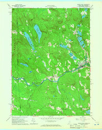
1964 Map of Kezar Falls
USGS Topo · Published 1966About this map
The Ossipee River carves a central path through this landscape, dividing the settlements of Porter and South Hiram as it flows eastward. This mid-1960s survey documents a region defined by its numerous small burial grounds and educational landmarks, including the Parsonsfield Seminary and the Old Meetinghouse located north of North Parsonsfield. The mapping of these sites, alongside various family plots like Sargent Cem and Libby Cem, offers a detailed view of the rural communities and lineage along the border of Maine and New Hampshire.
Find a feature on this map
64 named features on this map. Tap any name to fly to it.
Don’t see what you’re looking for? This feature index may not catch every label — zoom into the map to look around manually.
Map Details
Editions of this 1964 Kezar Falls Map
4 editions found
Other maps of this area

1891 · Newfield
USGS Topo · 1:62,500

1893 · Newfield
USGS Topo · 1:62,500

1910 · Kezar Falls
USGS Topo · 1:48,000

1911 · Kezar Falls
USGS Topo · 1:62,500

1928 · Wolfeboro
USGS Topo · 1:62,500

1930 · Ossipee Lake
USGS Topo · 1:62,500

1933 · Newfield
USGS Topo · 1:48,000

1937 · Newfield
USGS Topo · 1:62,500

1942 · Newfield
USGS Topo · 1:62,500

1944 · Newfield
USGS Topo · 1:62,500