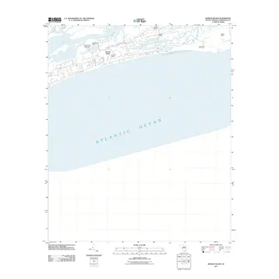
2011 Map of Kiawah Island
USGS Topo · Published 2011About this map
Kiawah Island and its intricate network of tidal waterways define this South Carolina coastal landscape at the start of the 2010s. The sheet captures the island's unique geography, where the Kiawah River separates the barrier island from the mainland, and interior wetlands are carved by Bass Creek and Cinder Creek. Civil engineering and leisure development are evident through features like the Kiawah Island Bass Pond D-3047 Dam and the world-renowned Ocean Course Golf Course positioned near the eastern tip of the island. Prominent marshland features such as Shullbred Point, Cinder Point, and Eagle Point provide specific geographic markers for those studying the evolving shoreline and land use patterns of this Lowcountry region.
Find a feature on this map
11 named features on this map. Tap any name to fly to it.
Don’t see what you’re looking for? This feature index may not catch every label — zoom into the map to look around manually.
Map Details
Editions of this 2011 Kiawah Island Map
This is the sole edition of this map. No revisions or reprints were ever made.
Other maps of this area

1918 · Kiawah Island
USGS Topo · 1:21,120

1919 · Wadmelaw Island
USGS Topo · 1:62,500

1919 · James Island
USGS Topo · 1:21,120

1919 · Legareville
USGS Topo · 1:21,120

1943 · Legareville
USGS Topo · 1:24,000

1943 · James Island
USGS Topo · 1:24,000

1943 · Kiawah Island
USGS Topo · 1:24,000

1944 · Wadmelaw Island
USGS Topo · 1:62,500

1947 · Savannah
USGS Topo · 1:250,000

1948 · James Island
USGS Topo · 1:250,000