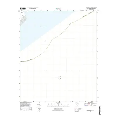
2017 Map of Kiawah Island OE E
USGS Topo · Published 2017About this map
Kiawah Island and the eastern reach of its sandy shoreline dominate the northwestern corner of this coastal survey, where the terrestrial landscape gives way to the open Atlantic Ocean. The geography is defined by the shifting barrier island dynamics at Sandy Point, situated where the tidal waters of the Stono Inlet meet the sea. This 2017 edition documents the coastal boundary of Charleston County as it extends far offshore, reflecting the importance of maritime jurisdictions in the Lowcountry. Because the majority of the map covers open water, it highlights the specific intersection of the Stono Inlet channel and the Atlantic, a critical point for local navigation and coastal geomorphology study.
Find a feature on this map
6 named features on this map. Tap any name to fly to it.
Don’t see what you’re looking for? This feature index may not catch every label — zoom into the map to look around manually.
Map Details
Editions of this 2017 Kiawah Island OE E Map
This is the sole edition of this map. No revisions or reprints were ever made.
Other maps of this area

1918 · Kiawah Island
USGS Topo · 1:21,120

1919 · The Jetties
USGS Topo · 1:21,120

1919 · Wadmelaw Island
USGS Topo · 1:62,500

1919 · James Island
USGS Topo · 1:21,120

1919 · Legareville
USGS Topo · 1:21,120

1943 · Legareville
USGS Topo · 1:24,000

1943 · James Island
USGS Topo · 1:24,000

1943 · Kiawah Island
USGS Topo · 1:24,000

1944 · Wadmelaw Island
USGS Topo · 1:62,500

1947 · Savannah
USGS Topo · 1:250,000