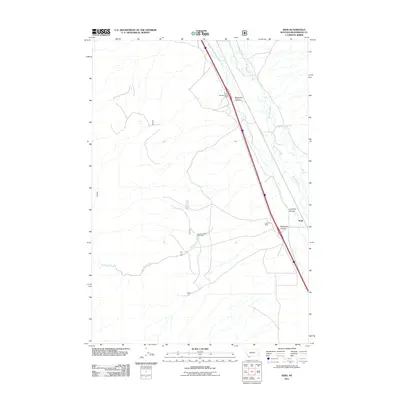
2011 Map of Kidd
USGS Topo · Published 2011About this map
Kidd and the surrounding high-altitude terrain of Beaverhead County are defined by the winding course of the Red Rock River and its tributary canyons. This 2011 survey illustrates a landscape primarily shaped by resource extraction and transportation, with the Kidd Pit Mine and Limekiln Canyon Creek Mine marking active or legacy industrial sites in the hills. The corridor along Red Rock Rd S and the interstate provide the primary transit through this part of southwest Montana, offering travelers a stopping point at the Dell Red Rock Rest Area. Topographical features such as McKenzie Canyon, Limekiln Canyon, and McKnight Canyon cut through the western slopes, while the seasonal flows of Kelmbeck Creek and Buck Creek drain toward the river basin. The map serves as a record of land use at the start of the 2010s, where traditional ranching and mining country meets modern highway infrastructure.
Find a feature on this map
11 named features on this map. Tap any name to fly to it.
Don’t see what you’re looking for? This feature index may not catch every label — zoom into the map to look around manually.
Map Details
Editions of this 2011 Kidd Map
This is the sole edition of this map. No revisions or reprints were ever made.
Other maps of this area

1955 · Dubois
USGS Topo · 1:250,000

1958 · Dubois
USGS Topo · 1:250,000
1965 · Garfield Canyon
USGS Topo · 1:24,000

1965 · Kidd
USGS Topo · 1:24,000
1965 · Monument Hill
USGS Topo · 1:24,000

1965 · Briggs Ranch
USGS Topo · 1:24,000
1965 · Red Rock
USGS Topo · 1:24,000

1965 · Graphite Mountain
USGS Topo · 1:24,000

1965 · Deer Canyon
USGS Topo · 1:24,000

1965 · Dixon Mountain
USGS Topo · 1:24,000