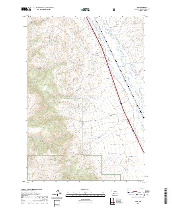
2024 Map of Kidd
USGS Topo · Published 2024About this map
The Tendoy Mountains dominate the western landscape of this Beaverhead County region, where steep drainages like McKenzie Canyon and Kelmbeck Creek descend toward the valley floor. Much of this upland territory is managed as part of the Beaverhead National Forest, reflecting the enduring importance of public land conservation in Montana's high country. To the east, the terrain transitions into the alluvial valley of the Red Rock River, which meanders northward alongside a primary transportation corridor.
Find a feature on this map
17 named features on this map. Tap any name to fly to it.
Don’t see what you’re looking for? This feature index may not catch every label — zoom into the map to look around manually.
Map Details
Editions of this 2024 Kidd Map
This is the sole edition of this map. No revisions or reprints were ever made.
Other maps of this area

1955 · Dubois
USGS Topo · 1:250,000

1958 · Dubois
USGS Topo · 1:250,000
1965 · Garfield Canyon
USGS Topo · 1:24,000

1965 · Kidd
USGS Topo · 1:24,000
1965 · Monument Hill
USGS Topo · 1:24,000

1965 · Briggs Ranch
USGS Topo · 1:24,000
1965 · Red Rock
USGS Topo · 1:24,000

1965 · Graphite Mountain
USGS Topo · 1:24,000

1965 · Deer Canyon
USGS Topo · 1:24,000

1965 · Dixon Mountain
USGS Topo · 1:24,000