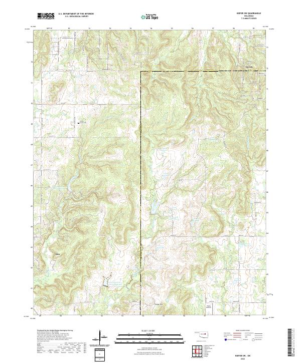
2022 Map of Kiefer SW
USGS Topo · Published 2022About this map
The borderlands of Creek and Okmulgee counties in Oklahoma are defined by a complex drainage system and small rural settlements. In the southwest corner, the town of Slick sits along the Slick Rd corridor, while the community of Mounds occupies the northeast. The landscape is characterized by numerous water management structures, including the Little Deep Fork Cr Site 51r Reservoir and 111004 Reservoir, which punctuate the drainages of Turkey Creek and Browns Creek. Genealogy researchers will find interest in the Sewell Family Cem located west of Turkey Creek, offering a point of connection for local family history. To the south, the Flying H Ranch and the topographic prominence of Osage Hill mark the transition toward the Okmulgee County line, where Checkerboard Creek and Tiger Creek flow through the eastern hills.
Find a feature on this map
79 named features on this map. Tap any name to fly to it.
Don’t see what you’re looking for? This feature index may not catch every label — zoom into the map to look around manually.
Map Details
Editions of this 2022 Kiefer SW Map
This is the sole edition of this map. No revisions or reprints were ever made.
Other maps of this area

1901 · Nuyaka
USGS Topo · 1:125,000

1914 · Kiefer
USGS Topo · 1:62,500

1916 · Kiefer
USGS Topo · 1:62,500

1916 · Bristow
USGS Topo · 1:62,500

1954 · Oklahoma City
USGS Topo · 1:250,000

1957 · Oklahoma City
USGS Topo · 1:250,000
1958 · Sapulpa South
USGS Topo · 1:24,000

1963 · Oklahoma City
USGS Topo · 1:250,000
1971 · Lake Heyburn
USGS Topo · 1:24,000
1972 · Kellyville
USGS Topo · 1:24,000