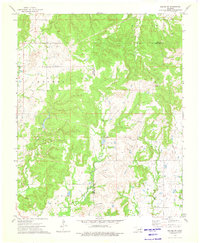
1973 Map of Kiefer SW
USGS Topo · Published 1976About this map
Oil field operations dominate the landscape of this region during the early 1970s, as evidenced by a dense concentration of petroleum infrastructure across the Creek Co Okmulgee Co border. The terrain is defined by the prominent Osage Hill and the broader highland area of Mounds in the north. A complex network of waterways, including Mountain Creek, Euchee Creek, and the uniquely named Checkerboard Cr, carves through the undulating topography.
Find a feature on this map
17 named features on this map. Tap any name to fly to it.
Don’t see what you’re looking for? This feature index may not catch every label — zoom into the map to look around manually.
Map Details
Editions of this 1973 Kiefer SW Map
This is the sole edition of this map. No revisions or reprints were ever made.
Other maps of this area

1901 · Nuyaka
USGS Topo · 1:125,000

1914 · Kiefer
USGS Topo · 1:62,500

1916 · Kiefer
USGS Topo · 1:62,500

1916 · Bristow
USGS Topo · 1:62,500

1954 · Oklahoma City
USGS Topo · 1:250,000

1957 · Oklahoma City
USGS Topo · 1:250,000
1958 · Sapulpa South
USGS Topo · 1:24,000

1963 · Oklahoma City
USGS Topo · 1:250,000
1971 · Lake Heyburn
USGS Topo · 1:24,000
1972 · Kellyville
USGS Topo · 1:24,000