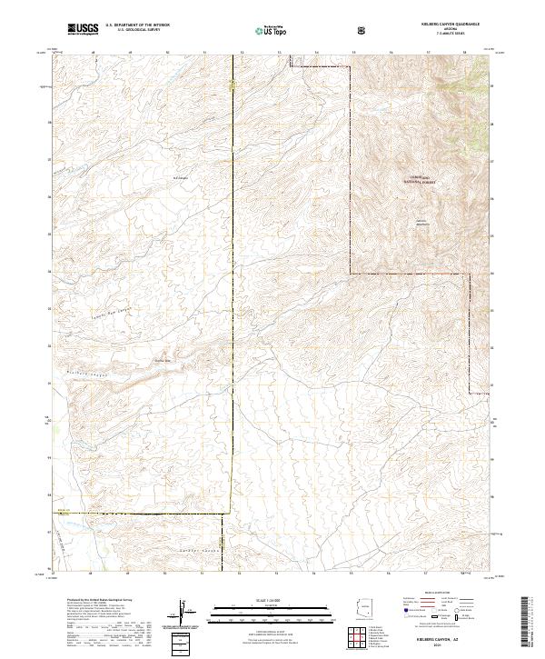
2021 Map of Kielberg Canyon
USGS Topo · Published 2021About this map
The San Pedro River corridor defines the southwestern corner of this Arizona landscape, marking a low-lying boundary before the terrain rises sharply into the high ridges of the Coronado National Forest. This 2021 topographic survey captures a complex system of drainage and relief where the Galiuro Mountains dominate the eastern half of the quadrangle. A series of deep incisions, including Kielberg Canyon and Gardner Canyon, track the westward flow of water toward the river valley. The map documents sparse but critical water management features in this arid environment, such as YLE Tank and the uniquely named Charlie Dike. While modern infrastructure is limited primarily to Whitlock RD and N San Pedro River Rd, the detailed contouring reveals the intricate network of washes like Peters Wash and Cienega Wash that shape the local geography.
Find a feature on this map
23 named features on this map. Tap any name to fly to it.
Don’t see what you’re looking for? This feature index may not catch every label — zoom into the map to look around manually.
Map Details
Editions of this 2021 Kielberg Canyon Map
This is the sole edition of this map. No revisions or reprints were ever made.
Other maps of this area

1904 · Tucson
USGS Topo · 1:125,000

1905 · Tucson
USGS Topo · 1:125,000

1911 · Winkelman
USGS Topo · 1:125,000

1913 · Winkelman
USGS Topo · 1:125,000

1938 · Galiuro Mts
USGS Topo · 1:48,000

1943 · Galiuro Mts
USGS Topo · 1:62,500

1945 · Redington
USGS Topo · 1:62,500

1948 · Clark Ranch
USGS Topo · 1:24,000

1948 · Mammoth
USGS Topo · 1:62,500

1948 · Peppersauce Wash
USGS Topo · 1:24,000