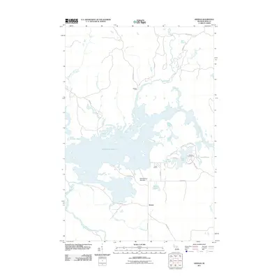
2011 Map of Kiernan
USGS Topo · Published 2011About this map
The Michigamme Reservoir dominates this landscape in Iron County, where the impounded waters of the Michigamme River create a complex shoreline of inlets and islands. This environment is defined by its water systems, including the Fence River, Ford River, and numerous smaller basins like Lake Ellen and North Deerskin Lake. To the south, the settlement of Kiernan sits near the junction of Peterson Rd and Way Dam Rd, while McMillan Camp is situated further north along the Fence River. High ground is marked by Michigamme Mountain, which stands as a prominent landmark overlooking the reservoir's eastern reaches. Aviation and recreation also leave their mark on the area through Huber Airport and the Lake Ellen Campground, reflecting the dual nature of this region as both a working watershed and a destination for outdoor pursuits.
Find a feature on this map
38 named features on this map. Tap any name to fly to it.
Don’t see what you’re looking for? This feature index may not catch every label — zoom into the map to look around manually.
Map Details
Editions of this 2011 Kiernan Map
This is the sole edition of this map. No revisions or reprints were ever made.
Other maps of this area

1895 · Ned Lake
USGS Topo · 1:62,500

1899 · Sagola
USGS Topo · 1:62,500

1899 · Witbeck
USGS Topo · 1:62,500

1899 · Crystal Falls
USGS Topo · 1:62,500

1944 · Crystal Falls
USGS Topo · 1:24,000

1945 · Kelso Junction
USGS Topo · 1:24,000

1946 · Crystal Falls
USGS Topo · 1:31,680

1947 · Kiernan
USGS Topo · 1:24,000

1947 · Lake Mary
USGS Topo · 1:24,000

1947 · Kelso Junction
USGS Topo · 1:24,000