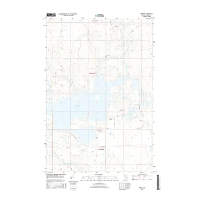
2014 Map of Kiernan
USGS Topo · Published 2014About this map
The settlement of Kiernan sits at the junction of Peterson Rd and Waydam Rd, serving as a small focal point in a landscape dominated by the extensive Michigamme Reservoir. This water system creates a complex shoreline of inlets and points, including the distinctively named Crotch Lake and North Deerskin Lake. To the north, the Fence River and Threemile Cr snake through the terrain, while the heights of Michigamme Mtn provide a backdrop to Butler Lake. A small aviation footprint is visible at Huber Airport, located near Lake Ellen. The network of local routes like Baptist Camp Rd and Channing Rd connects the scattered lakes and recreation areas, such as Margeson Falls on the western edge of the quadrangle, illustrating the Michigan Upper Peninsula's mix of natural timberland and managed water resources.
Find a feature on this map
40 named features on this map. Tap any name to fly to it.
Don’t see what you’re looking for? This feature index may not catch every label — zoom into the map to look around manually.
Map Details
Editions of this 2014 Kiernan Map
This is the sole edition of this map. No revisions or reprints were ever made.
Other maps of this area

1895 · Ned Lake
USGS Topo · 1:62,500

1899 · Sagola
USGS Topo · 1:62,500

1899 · Witbeck
USGS Topo · 1:62,500

1899 · Crystal Falls
USGS Topo · 1:62,500

1944 · Crystal Falls
USGS Topo · 1:24,000

1945 · Kelso Junction
USGS Topo · 1:24,000

1946 · Crystal Falls
USGS Topo · 1:31,680

1947 · Kiernan
USGS Topo · 1:24,000

1947 · Lake Mary
USGS Topo · 1:24,000

1947 · Kelso Junction
USGS Topo · 1:24,000