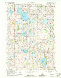
1966 Map of Kilkenny
USGS Topo · Published 1988About this map
Kilkenny serves as the central hub of this 1960s landscape, positioned at the intersection of the Chicago and North Western railroad and the Cannon River. The geography is defined by a dense network of glacial lakes and wetlands, including the expansive Lake Dora and Diamond Lake. This area reflects a mid-century commitment to conservation and waterfowl habitat, evidenced by the Diamond Lake State Wildlife Management Area and the Murphy State Wildlife Management Area.
Find a feature on this map
26 named features on this map. Tap any name to fly to it.
Don’t see what you’re looking for? This feature index may not catch every label — zoom into the map to look around manually.
Map Details
Editions of this 1966 Kilkenny Map
2 editions found
Other maps of this area

1953 · Saint Paul
USGS Topo · 1:250,000

1959 · Saint Paul
USGS Topo · 1:250,000

1960 · Shieldsville
USGS Topo · 1:24,000

1960 · Lonsdale
USGS Topo · 1:24,000

1962 · Morristown
USGS Topo · 1:24,000

1966 · Montgomery
USGS Topo · 1:24,000

1966 · Waterville
USGS Topo · 1:24,000

1966 · Cordova
USGS Topo · 1:24,000

1966 · Elysian
USGS Topo · 1:24,000

1966 · Le Center
USGS Topo · 1:24,000