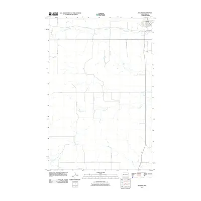
2011 Map of Killdeer
USGS Topo · Published 2011About this map
Killdeer sits at the northern edge of this 2011 survey, serving as the primary hub in a landscape defined by the drainage basins of the Knife River and Little Knife River. The surrounding plains are etched by a network of waterways including Wolf Creek, Spring Creek, and Murphy Creek, which dictate the local topography and the placement of the section-line road system. This grid of rural routes, such as 109th Ave SW and Spring Creek Rd, connects the outlying ranching and agricultural lands back to the town center. Local history and genealogy interest is anchored by the Killdeer Cemetery, located just south of the main settlement along Jason Ave. The map reflects a modern moment in Dunn County where the established township layout remains central to the region's geographic identity.
Find a feature on this map
19 named features on this map. Tap any name to fly to it.
Don’t see what you’re looking for? This feature index may not catch every label — zoom into the map to look around manually.
Map Details
Editions of this 2011 Killdeer Map
This is the sole edition of this map. No revisions or reprints were ever made.
Other maps of this area

1953 · Watford City
USGS Topo · 1:250,000

1957 · Watford City
USGS Topo · 1:250,000

1967 · Watford City
USGS Topo · 1:250,000

1970 · Dunn Center NW
USGS Topo · 1:24,000

1973 · Manning
USGS Topo · 1:24,000

1973 · Manning NW
USGS Topo · 1:24,000

1973 · Emerson
USGS Topo · 1:24,000

1973 · Lake Ilo
USGS Topo · 1:24,000

1974 · Killdeer
USGS Topo · 1:100,000

1974 · Fayette
USGS Topo · 1:24,000