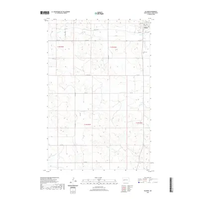
2020 Map of Killdeer
USGS Topo · Published 2020About this map
Killdeer occupies the northeastern corner of this Dunn County landscape, situated where the high plains begin to break toward the drainage basins of the south. The town's layout is centered near Dakota St and High St NW, with the Killdeer Cem located just to the southeast. This survey captures a transition in the local hydrology, as multiple tributaries such as Spring Cr and Murphy Cr flow eastward, while the southern portion of the map is defined by the larger course of the Knife River and its tributary, the Little Knife River. The terrain is marked by a network of section-line roads, including 111th Ave SW and 10th St SW, which illustrate the enduring grid of the Public Land Survey System across this ranching and agricultural region of North Dakota.
Find a feature on this map
28 named features on this map. Tap any name to fly to it.
Don’t see what you’re looking for? This feature index may not catch every label — zoom into the map to look around manually.
Map Details
Editions of this 2020 Killdeer Map
This is the sole edition of this map. No revisions or reprints were ever made.
Other maps of this area

1953 · Watford City
USGS Topo · 1:250,000

1957 · Watford City
USGS Topo · 1:250,000

1967 · Watford City
USGS Topo · 1:250,000

1970 · Dunn Center NW
USGS Topo · 1:24,000

1973 · Manning
USGS Topo · 1:24,000

1973 · Manning NW
USGS Topo · 1:24,000

1973 · Emerson
USGS Topo · 1:24,000

1973 · Lake Ilo
USGS Topo · 1:24,000

1974 · Killdeer
USGS Topo · 1:100,000

1974 · Fayette
USGS Topo · 1:24,000