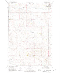
1974 Map of Killdeer
USGS Topo · Published 1977About this map
Killdeer serves as the primary hub on this mid-1970s map, situated near the headwaters of Spring Creek and the southern slopes of the Killdeer Mountains. The town's infrastructure includes a Water Tank, a Landing Strip, and the B N railroad line, which terminates near the settlement center. To the south, the landscape is defined by the winding course of the Knife River, which flows through sections 32, 33, and 34. The presence of a Scoria Pit and multiple Gravel Pits points to the local extractive industry that supported road building and regional development. Local history is anchored at the Killdeer Cem, while the rugged drainage patterns of Murphy Creek illustrate the natural topography that directed early ranching and travel through Dunn County.
Find a feature on this map
15 named features on this map. Tap any name to fly to it.
Don’t see what you’re looking for? This feature index may not catch every label — zoom into the map to look around manually.
Map Details
Editions of this 1974 Killdeer Map
This is the sole edition of this map. No revisions or reprints were ever made.
Other maps of this area

1953 · Watford City
USGS Topo · 1:250,000

1957 · Watford City
USGS Topo · 1:250,000

1967 · Watford City
USGS Topo · 1:250,000

1970 · Dunn Center NW
USGS Topo · 1:24,000

1973 · Manning
USGS Topo · 1:24,000

1973 · Manning NW
USGS Topo · 1:24,000

1973 · Emerson
USGS Topo · 1:24,000

1973 · Lake Ilo
USGS Topo · 1:24,000

1974 · Killdeer
USGS Topo · 1:100,000

1974 · Fayette
USGS Topo · 1:24,000