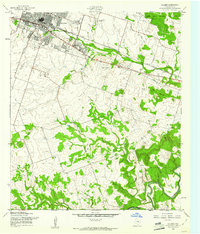
1958 Map of Killeen
USGS Topo · Published 1961About this map
The Killeen area in the late 1950s is defined by its adjacency to the Fort Hood Military Reservation, showing the city's early expansion toward the south and east. Residential growth is anchored by community landmarks such as East Ward Sch, Marlboro Sch, and the St Joseph Sch, while the commercial and transport corridor follows the Gulf Colorado and Santa Fe (AT & SF) railroad and U.S. Highway 190. Outside the urban core, the landscape transitions into the hills of the Douglas Mountains and Miller Mountain. To the south, the Lampasas River meanders through more rural terrain, fed by Trimmer Creek and Rock Creek. Aviation history is captured at Skylark Airfield, and local genealogy is well-supported by several burial grounds, including the City Cem and Pleasant Hill Cem.
Find a feature on this map
27 named features on this map. Tap any name to fly to it.
Don’t see what you’re looking for? This feature index may not catch every label — zoom into the map to look around manually.
Map Details
Editions of this 1958 Killeen Map
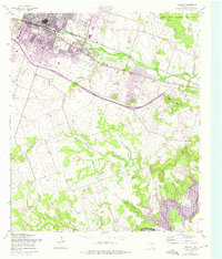
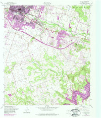
Other maps of this area

1893 · Georgetown
USGS Topo · 1:125,000

1894 · Gatesville
USGS Topo · 1:125,000

1924 · Gatesville 4-d
USGS Topo · 1:48,000

1924 · Gatesville 4-a
USGS Topo · 1:48,000

1930 · Killeen
USGS Topo · 1:62,500

1947 · Fort Hood
USGS Topo · 1:62,500

1947 · Bland
USGS Topo · 1:24,000

1947 · Fort Hood
USGS Topo · 1:24,000

1947 · Post Oak Mountain
USGS Topo · 1:24,000

1947 · Killeen
USGS Topo · 1:62,500