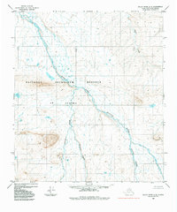
1984 Map of Killik River C-5
USGS Topo · Published 1984About this map
The National Petroleum Reserve in Alaska dominates this 1980s landscape, illustrating a period of high-latitude resource management and topographic surveying in the North Slope Borough. This remote arctic terrain is defined by a dense network of braided waterways and thermokarst features, where the East Fork Etivluk River serves as the primary drainage artery. The river is fed by several significant tributaries, including Iteriak Creek, Otuk Creek, and Ivotuk Creek, each winding through the tundra with complex meanders and nearby small lake clusters. The absence of roads or permanent structures reflects the wilderness state of this federally managed area during the mid-1970s photogrammetric surveys. Researchers can examine the detailed glacial and fluvial landforms, including the drainage patterns of Kuchek Creek in the northeastern reaches of the quadrangle.
Find a feature on this map
6 named features on this map. Tap any name to fly to it.
Don’t see what you’re looking for? This feature index may not catch every label — zoom into the map to look around manually.
Map Details
Editions of this 1984 Killik River C-5 Map
This is the sole edition of this map. No revisions or reprints were ever made.
Other maps of this area

1951 · Howard Pass
USGS Topo · 1:250,000

1951 · Killik River
USGS Topo · 1:250,000

1956 · Howard Pass
USGS Topo · 1:250,000

1956 · Killik River
USGS Topo · 1:250,000
1984 · Killik River B-5
USGS Topo · 1:63,360
1984 · Howard Pass B-1
USGS Topo · 1:63,360

1984 · Howard Pass D-1
USGS Topo · 1:63,360

1984 · Howard Pass C-1
USGS Topo · 1:63,360

1984 · Killik River D-5
USGS Topo · 1:63,360
1986 · Killik River C-4
USGS Topo · 1:63,360