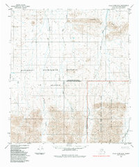
1984 Map of Killik River B-5
USGS Topo · Published 1984About this map
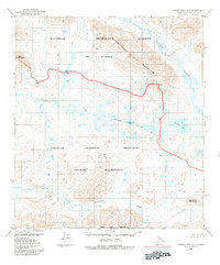
Gates of the Arctic National Park and the Gates of the Arctic Wilderness define the eastern portion of this 1984 survey, where the Brooks Range landscape meets the North Slope. This map captures a significant administrative boundary at the South Boundary Umiat Meridian North Boundary Kateel River Meridian, marking the intersection of the National Petroleum Reserve in Alaska with protected wilderness areas. The terrain is characterized by the Ivotuk Hills and a network of northward-flowing waterways, including Iteriak Creek, Otuk Creek, and Ivotuk Creek. The absence of roads or trails across the entire quadrangle emphasizes the remote character of this region during the mid-1980s. Geologic and environmental researchers can trace the intricate drainage patterns of the Fork Ivotuk River as they relate to these major federal land designations.
Find a feature on this map
9 named features on this map. Tap any name to fly to it.
Don’t see what you’re looking for? This feature index may not catch every label — zoom into the map to look around manually.
Map Details
Editions of this 1984 Killik River B-5 Map
This is the sole edition of this map. No revisions or reprints were ever made.
Other maps of this area

1951 · Howard Pass
USGS Topo · 1:250,000

1951 · Killik River
USGS Topo · 1:250,000

1956 · Howard Pass
USGS Topo · 1:250,000

1956 · Killik River
USGS Topo · 1:250,000
1984 · Howard Pass B-1
USGS Topo · 1:63,360
1984 · Killik River A-5
USGS Topo · 1:63,360

1984 · Howard Pass C-1
USGS Topo · 1:63,360
1984 · Killik River C-5
USGS Topo · 1:63,360
1984 · Howard Pass A-1
USGS Topo · 1:63,360
1986 · Killik River A-4
USGS Topo · 1:63,360