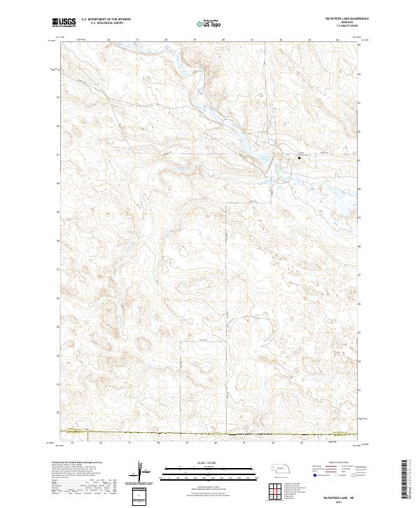
2021 Map of Kilpatrick Lake
USGS Topo · Published 2021About this map
Kilpatrick Lake and the winding course of Snake Cr define this landscape on the southern edge of Box Butte County. The area is marked by the drainages of Spring Cr and several county routes that traverse the township lines, including Perkins Rd and Valley Rd. For those researching local history or genealogy, the Snake Creek Cem serves as a significant landmark near the lake. The map details the transition between Box Butte and its neighbors, Scotts Bluff and Morrill counties, showing a rural environment characterized by intermittent water features and established section boundaries.
Find a feature on this map
19 named features on this map. Tap any name to fly to it.
Don’t see what you’re looking for? This feature index may not catch every label — zoom into the map to look around manually.
Map Details
Editions of this 2021 Kilpatrick Lake Map
This is the sole edition of this map. No revisions or reprints were ever made.
Other maps of this area

1898 · Camp Clarke
USGS Topo · 1:125,000

1948 · Hemingford 4 SW
USGS Topo · 1:24,000

1948 · Hemingford 4 NW
USGS Topo · 1:24,000

1951 · Kilpatrick Lake
USGS Topo · 1:62,500

1954 · Scottsbluff
USGS Topo · 1:250,000

1955 · Alliance
USGS Topo · 1:250,000

1957 · Alliance
USGS Topo · 1:250,000

1958 · Alliance
USGS Topo · 1:250,000

1958 · Scottsbluff
USGS Topo · 1:250,000
1965 · Bayard NE
USGS Topo · 1:24,000