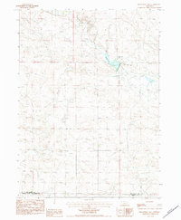
1983 Map of Kilpatrick Lake
USGS Topo · Published 1984About this map
Kilpatrick Lake and the winding course of Snake Creek anchor this early 1980s landscape on the border of Box Butte and Morrill counties. The area is defined by a sparse ranching and irrigation-dependent economy, centered on the Snake Creek Ranch and a complex network of wells. Local history is grounded in community landmarks such as the Snake Creek Cemetery and School Number 22, providing valuable points of reference for genealogists tracking family roots in this corner of the Nebraska panhandle. The map illustrates a transitional terrain where seasonal watercourses like Spring Creek intersect with numerous irrigation wells, reflecting the intensive agricultural management of the region's high plains.
Find a feature on this map
9 named features on this map. Tap any name to fly to it.
Don’t see what you’re looking for? This feature index may not catch every label — zoom into the map to look around manually.
Map Details
Editions of this 1983 Kilpatrick Lake Map
This is the sole edition of this map. No revisions or reprints were ever made.
Other maps of this area

1898 · Camp Clarke
USGS Topo · 1:125,000

1948 · Hemingford 4 SW
USGS Topo · 1:24,000

1948 · Hemingford 4 NW
USGS Topo · 1:24,000

1951 · Kilpatrick Lake
USGS Topo · 1:62,500

1954 · Scottsbluff
USGS Topo · 1:250,000

1955 · Alliance
USGS Topo · 1:250,000

1957 · Alliance
USGS Topo · 1:250,000

1958 · Alliance
USGS Topo · 1:250,000

1958 · Scottsbluff
USGS Topo · 1:250,000
1965 · Bayard NE
USGS Topo · 1:24,000