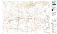
1985 Map of Kimball
USGS Topo · Published 1989About this map
Lodgepole Creek serves as the central artery for this High Plains landscape, where the agricultural and industrial patterns of the mid-1980s are clearly etched across the Nebraska-Colorado border. The map documents a corridor of growth along the rail and highway lines connecting Bushnell, Kimball, Dix, and Potter. An extensive network of oil and gas fields, including the widespread Oil Field and Gas Field labels, indicates the heavy energy extraction characteristic of the region during this era.
Find a feature on this map
30 named features on this map. Tap any name to fly to it.
Don’t see what you’re looking for? This feature index may not catch every label — zoom into the map to look around manually.
Map Details
Editions of this 1985 Kimball Map
2 editions found
Other maps of this area

1896 · Browns Creek
USGS Topo · 1:125,000

1898 · Scotts Bluff
USGS Topo · 1:125,000

1898 · Camp Clarke
USGS Topo · 1:125,000

1899 · Browns Creek
USGS Topo · 1:125,000

1899 · Sidney
USGS Topo · 1:125,000

1899 · Goshen Hole
USGS Topo · 1:125,000

1951 · Padroni NW
USGS Topo · 1:24,000

1953 · Peetz
USGS Topo · 1:24,000

1953 · Haystack Butte
USGS Topo · 1:24,000

1954 · Sterling
USGS Topo · 1:250,000