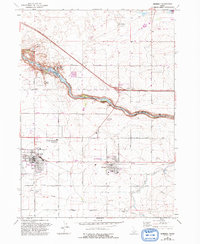
1964 Map of Kimberly
USGS Topo · Published 1992About this map
The Snake River carves a dramatic gorge through the center of this Idaho landscape, separating Jerome Co to the north from Twin Falls Co to the south. The terrain is defined by the sharp contrast between the deep volcanic canyons and the productive agricultural plains above. Notable geologic features like Devils Corral, Box Canyon, and Clay Caves dot the rim, while the historic river crossing at Hansen Bridge provides a critical link between the communities.
Find a feature on this map
34 named features on this map. Tap any name to fly to it.
Don’t see what you’re looking for? This feature index may not catch every label — zoom into the map to look around manually.
Map Details
Editions of this 1964 Kimberly Map
2 editions found
Other maps of this area

1955 · Twin Falls
USGS Topo · 1:250,000

1958 · Twin Falls
USGS Topo · 1:250,000

1964 · Kimberly
USGS Topo · 1:24,000

1964 · Falls City
USGS Topo · 1:24,000

1964 · Twin Falls
USGS Topo · 1:24,000

1964 · Eden
USGS Topo · 1:24,000

1964 · Perrine
USGS Topo · 1:24,000

1964 · Hunt
USGS Topo · 1:24,000

1965 · Stricker Butte
USGS Topo · 1:24,000

1965 · Hub Butte
USGS Topo · 1:24,000