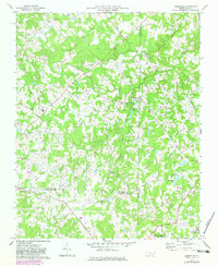
1970 Map of Kimesville
USGS Topo · Published 1983About this map
The community of Kimesville anchors this Piedmont landscape at the convergence of several waterways, including Kimesville Lake and the branching prongs of Stinking Quarter Creek. This 1970s record, updated with early 1980s data, illustrates a rural transition where traditional landmarks like Greene School and numerous country churches—such as Macedonia Church and Mt Zion Church—sit alongside modern developments like the Drag Strip and pipelines. The Southern railroad cuts through the southern portion of the quadrangle, serving the agricultural and industrial needs of the borderlands where Guilford, Alamance, and Randolph counties meet. Aviation is represented by both Causey Airport and Hinshaw-Greenacres Airport, signaling the area's increasing connectivity during the late twentieth century.
Find a feature on this map
27 named features on this map. Tap any name to fly to it.
Don’t see what you’re looking for? This feature index may not catch every label — zoom into the map to look around manually.
Map Details
Editions of this 1970 Kimesville Map
2 editions found
Other maps of this area

1952 · Mc Leansville
USGS Topo · 1:24,000

1953 · Raleigh
USGS Topo · 1:250,000

1953 · Greensboro
USGS Topo · 1:250,000

1954 · Greensboro
USGS Topo · 1:250,000

1954 · Raleigh
USGS Topo · 1:250,000

1962 · Greensboro
USGS Topo · 1:250,000

1966 · Greensboro
USGS Topo · 1:250,000

1969 · Burlington
USGS Topo · 1:24,000

1970 · Gibsonville
USGS Topo · 1:24,000

1970 · Kimesville
USGS Topo · 1:24,000