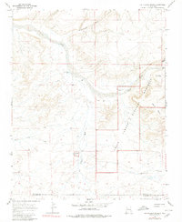
1966 Map of Kin Klizhin Ruins
USGS Topo · Published 1980About this map
Chaco Canyon National Monument spans the eastern portion of this high-desert landscape, preserving significant archaeological sites from the pre-contact era. The Chaco River and its numerous tributaries, including Kin Klizhin Wash and Ah-shi-sle-pah Wash, dictate the drainage patterns across the arid terrain. The map highlights key historical landmarks such as the Kin Klizhin Ruins and the Peñasco Blanco Ruins, which sit atop prominent landforms like West Mesa.
Find a feature on this map
15 named features on this map. Tap any name to fly to it.
Don’t see what you’re looking for? This feature index may not catch every label — zoom into the map to look around manually.
Map Details
Editions of this 1966 Kin Klizhin Ruins Map
Other maps of this area

1883 · Mt. Taylor
USGS Topo · 1:250,000

1886 · Wingate
USGS Topo · 1:250,000

1886 · Mt. Taylor
USGS Topo · 1:250,000

1889 · Largo
USGS Topo · 1:250,000

1889 · Chaco
USGS Topo · 1:250,000

1892 · Wingate
USGS Topo · 1:250,000

1892 · Chaco
USGS Topo · 1:250,000

1892 · Mt. Taylor
USGS Topo · 1:250,000

1895 · Largo
USGS Topo · 1:250,000

1899 · Mt. Taylor
USGS Topo · 1:250,000