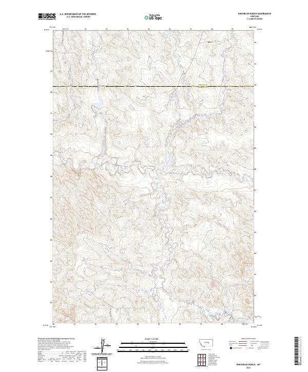
2024 Map of Kincheloe Ranch
USGS Topo · Published 2024About this map
Kincheloe Rd winds through the high prairie of eastern Montana, providing a terrestrial anchor in a landscape defined by its complex drainage systems. Crossing the boundary between Garfield and Rosebud Counties, the map reveals the intricate network of coulees and creeks that shape this ranchland. The terrain is marked by significant waterways like Jacobsen Coulee and Rattlesnake Creek, which cut through the open country. These natural features, along with Big Breed Creek and Little Breed Creek, dictate the movement and settlement patterns across the townships of this vast grazing region. The 2024 survey detail preserves the contemporary alignment of rural tracks against the ancient contours of the northern plains, illustrating how modern ranching infrastructure follows the lead of the land's natural hydrology and traditional boundaries.
Find a feature on this map
13 named features on this map. Tap any name to fly to it.
Don’t see what you’re looking for? This feature index may not catch every label — zoom into the map to look around manually.
Map Details
Editions of this 2024 Kincheloe Ranch Map
This is the sole edition of this map. No revisions or reprints were ever made.
Other maps of this area

1954 · Forsyth
USGS Topo · 1:250,000

1957 · Forsyth
USGS Topo · 1:250,000

1958 · Forsyth
USGS Topo · 1:250,000

1962 · Melstone NE
USGS Topo · 1:24,000

1962 · Kincheloe Ranch
USGS Topo · 1:24,000

1962 · Mosby SE
USGS Topo · 1:24,000

1962 · Grebe Ranch
USGS Topo · 1:24,000
1963 · Hill Ranch
USGS Topo · 1:24,000

1963 · Mc Williams Springs
USGS Topo · 1:24,000

1963 · Hecker Ranch
USGS Topo · 1:24,000