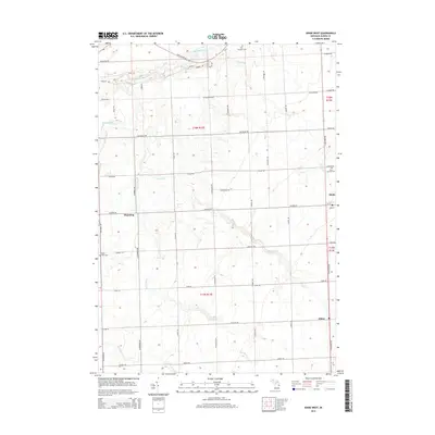
2014 Map of Kinde West
USGS Topo · Published 2014About this map
The Pinnebog River winds through the agricultural landscape of northern Huron County, flowing north toward the lake. This 2014 survey documents the enduring rural structure of the Thumb region, where small hubs like Pinnebog and Filion anchor a grid of family-named roads including Stiebe Rd and Ahearn Rd. The village of Kinde serves as a primary local center in the east, situated at the intersection of W Kinde Rd and the corridor of N Van Dyke Rd.
Find a feature on this map
52 named features on this map. Tap any name to fly to it.
Don’t see what you’re looking for? This feature index may not catch every label — zoom into the map to look around manually.
Map Details
Editions of this 2014 Kinde West Map
This is the sole edition of this map. No revisions or reprints were ever made.
Other maps of this area

1954 · Flint
USGS Topo · 1:250,000

1954 · Tawas City
USGS Topo · 1:250,000

1958 · Flint
USGS Topo · 1:250,000

1958 · Tawas City
USGS Topo · 1:250,000
1970 · Rush Lake
USGS Topo · 1:24,000

1970 · Port Austin East
USGS Topo · 1:24,000

1970 · Kinde East
USGS Topo · 1:24,000

1970 · Port Austin West
USGS Topo · 1:24,000

1970 · Kinde West
USGS Topo · 1:24,000

1970 · Bad Axe West
USGS Topo · 1:24,000