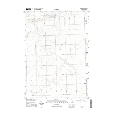
2017 Map of Kinde West
USGS Topo · Published 2017About this map
Pinnebog and the smaller settlements of Kinde and Filion anchor this corner of Huron County, illustrating the agricultural and creek-fed layout of the Michigan Thumb. The landscape is defined by a dense grid of section roads, such as Port Austin Rd and Filion Rd, which connect rural farmsteads to the local centers of commerce and faith. Waterways like the Pinnebog River and Schram Br provide the primary drainage for the surrounding fields, while the presence of Saint Edwards Cem and Saint Felix Cem offers specific points of interest for genealogists tracing local family histories. The rectilinear property lines and road network, including the prominent N Van Dyke Rd, reveal a highly organized land system that has supported the region's farming community since its early development.
Find a feature on this map
52 named features on this map. Tap any name to fly to it.
Don’t see what you’re looking for? This feature index may not catch every label — zoom into the map to look around manually.
Map Details
Editions of this 2017 Kinde West Map
This is the sole edition of this map. No revisions or reprints were ever made.
Other maps of this area

1954 · Flint
USGS Topo · 1:250,000

1954 · Tawas City
USGS Topo · 1:250,000

1958 · Flint
USGS Topo · 1:250,000

1958 · Tawas City
USGS Topo · 1:250,000
1970 · Rush Lake
USGS Topo · 1:24,000

1970 · Port Austin East
USGS Topo · 1:24,000

1970 · Kinde East
USGS Topo · 1:24,000

1970 · Port Austin West
USGS Topo · 1:24,000

1970 · Kinde West
USGS Topo · 1:24,000

1970 · Bad Axe West
USGS Topo · 1:24,000