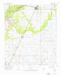
1959 Map of Kinder
USGS Topo · Published 1976About this map
The Calcasieu River defines the western edge of this landscape, where the prairie of southwest Louisiana meets the piney woods. In the mid-20th century, this region supported a diverse economy of timber, rice irrigation, and petroleum extraction. The town of Kinder serves as the primary hub, situated at the intersection of the Missouri Pacific and the Kinder & Northwestern RR. Local history is deeply etched into the rural landscape through family-named landmarks like Nevil Cem and Phillips Bluff, alongside several rural congregations such as Sacred Heart Ch and Pentecostal Ch.
Find a feature on this map
44 named features on this map. Tap any name to fly to it.
Don’t see what you’re looking for? This feature index may not catch every label — zoom into the map to look around manually.
Map Details
Editions of this 1959 Kinder Map
4 editions found
Other maps of this area

1932 · Lake Charles NE
USGS Topo · 1:31,680

1942 · Lake Charles
USGS Topo · 1:62,500

1946 · Lacassine
USGS Topo · 1:31,680

1946 · Jennings
USGS Topo · 1:31,680

1947 · Kinder
USGS Topo · 1:31,680

1947 · Fenton
USGS Topo · 1:31,680

1947 · Oberlin
USGS Topo · 1:31,680

1947 · Hecker
USGS Topo · 1:31,680

1947 · Pine Island
USGS Topo · 1:31,680

1947 · Welsh
USGS Topo · 1:31,680