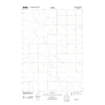
2012 Map of King Dam
USGS Topo · Published 2012About this map
Thunder Cr meanders through this portion of Tripp County, defining the drainage patterns of a landscape marked by rural infrastructure and water management. The area is anchored by the presence of Ideal Cem in the southwestern quadrant, a significant point of interest for those tracing local family histories and genealogies in South Dakota. Small-scale water engineering is evident through the naming of King Dam and Covey Dam, which serve as local landmarks in an otherwise open prairie environment. The rectangular survey system is reflected in the rigid grid of section roads, including North-South corridors like 318th Ave and East-West routes such as Co Rd-6140. This topography shows the persistent agrarian organization of the plains in the early twenty-first century, where every square mile is accessible by a network of numbered avenues and streets.
Find a feature on this map
18 named features on this map. Tap any name to fly to it.
Don’t see what you’re looking for? This feature index may not catch every label — zoom into the map to look around manually.
Map Details
Editions of this 2012 King Dam Map
This is the sole edition of this map. No revisions or reprints were ever made.
Other maps of this area

1951 · Ideal NW
USGS Topo · 1:24,000

1951 · Ideal NE
USGS Topo · 1:24,000

1952 · Hamill NW
USGS Topo · 1:24,000

1955 · Mitchell
USGS Topo · 1:250,000

1959 · Mitchell
USGS Topo · 1:250,000

1971 · Hamill
USGS Topo · 1:24,000

1971 · Rattlesnake Butte West
USGS Topo · 1:24,000

1982 · King Dam
USGS Topo · 1:25,000

1982 · Winner North
USGS Topo · 1:25,000
1982 · Miller Hill
USGS Topo · 1:25,000