
2015 Map of King Dam
USGS Topo · Published 2015About this map
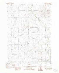
Thunder Creek meanders through the heart of this Tripp County landscape, defining the local drainage patterns south of Covey Dam. The area is characterized by a high-altitude prairie landscape where agricultural land is partitioned by an organized grid of section-line roads, including 264th St and 318th Ave. A focal point for local history is the Ideal Cemetery, located near the intersection of 266th St and 315th Ave, which serves as a primary marker for the Ideal community. The map also highlights significant water management features like the King Dam, which provides essential water storage in this semi-arid region of South Dakota. The presence of routes like Cr-6139 suggests a reliance on a well-maintained rural infrastructure to connect these remote holdings and water resources.
Find a feature on this map
23 named features on this map. Tap any name to fly to it.
Don’t see what you’re looking for? This feature index may not catch every label — zoom into the map to look around manually.
Map Details
Editions of this 2015 King Dam Map
This is the sole edition of this map. No revisions or reprints were ever made.
Other maps of this area

1951 · Ideal NW
USGS Topo · 1:24,000

1951 · Ideal NE
USGS Topo · 1:24,000

1952 · Hamill NW
USGS Topo · 1:24,000

1955 · Mitchell
USGS Topo · 1:250,000

1959 · Mitchell
USGS Topo · 1:250,000

1971 · Hamill
USGS Topo · 1:24,000

1971 · Rattlesnake Butte West
USGS Topo · 1:24,000

1982 · King Dam
USGS Topo · 1:25,000

1982 · Winner North
USGS Topo · 1:25,000
1982 · Miller Hill
USGS Topo · 1:25,000