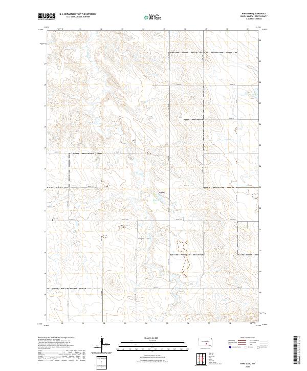
2021 Map of King Dam
USGS Topo · Published 2021About this map
Thunder Cr meanders through the central plains of Tripp County, marking the drainage patterns of this rural landscape in the southern reaches of South Dakota. The land is largely defined by the township and range survey system, with a grid of section lines and secondary routes like Co Rd 6140 providing the primary framework for movement across the prairie. Local history is anchored at the Ideal Cem, located near the western edge of the map, serving as a significant site for genealogical research in this sparsely populated region. Water management is a central theme of the terrain, visible through features such as King Dam and Covey Dam, which emphasize the importance of artificial reservoirs for ranching and agriculture in a landscape defined by intermittent creek beds and wide, rolling draws.
Find a feature on this map
15 named features on this map. Tap any name to fly to it.
Don’t see what you’re looking for? This feature index may not catch every label — zoom into the map to look around manually.
Map Details
Editions of this 2021 King Dam Map
This is the sole edition of this map. No revisions or reprints were ever made.
Other maps of this area

1951 · Ideal NW
USGS Topo · 1:24,000

1951 · Ideal NE
USGS Topo · 1:24,000

1952 · Hamill NW
USGS Topo · 1:24,000

1955 · Mitchell
USGS Topo · 1:250,000

1959 · Mitchell
USGS Topo · 1:250,000

1971 · Hamill
USGS Topo · 1:24,000

1971 · Rattlesnake Butte West
USGS Topo · 1:24,000

1982 · King Dam
USGS Topo · 1:25,000

1982 · Winner North
USGS Topo · 1:25,000
1982 · Miller Hill
USGS Topo · 1:25,000