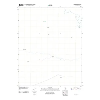
2011 Map of King Mesa
USGS Topo · Published 2011About this map
The Escalante River winds through the northeast corner of this high desert landscape, carving deep into the plateau near Fools Canyon. This area of Kane County is defined by its dramatic geologic formations, including the prominent elevation of King Mesa and the distinctive landmark of Chimney Rock. Human presence is sparse, marked primarily by the seasonal water source at Gates Tank and the primitive track following Fortymile Ridge in the south. Drainage systems like Hurricane Wash and Dry Fork Coyote Gulch dictate the movement across this terrain, illustrating the hydrologic patterns of the western desert. Named features like Les George Point and Scorpion provide essential orientation points for those navigating this isolated portion of the Utah wilderness.
Find a feature on this map
10 named features on this map. Tap any name to fly to it.
Don’t see what you’re looking for? This feature index may not catch every label — zoom into the map to look around manually.
Map Details
Editions of this 2011 King Mesa Map
This is the sole edition of this map. No revisions or reprints were ever made.
Other maps of this area

1886 · Escalante
USGS Topo · 1:250,000

1886 · Henry Mountains
USGS Topo · 1:250,000

1892 · Henry Mountains
USGS Topo · 1:250,000

1953 · Mt Pennell 3 SW
USGS Topo · 1:24,000

1953 · Circle Cliffs 4 SW
USGS Topo · 1:24,000

1953 · The Rincon
USGS Topo · 1:62,500

1953 · Hall Mesa
USGS Topo · 1:62,500

1953 · Moody Creek
USGS Topo · 1:62,500

1956 · Escalante
USGS Topo · 1:250,000

1960 · Escalante
USGS Topo · 1:250,000