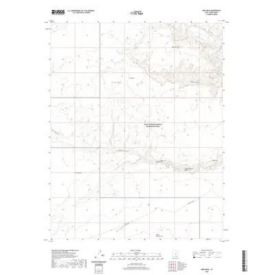
2020 Map of King Mesa
USGS Topo · Published 2020About this map
Jacob Hamblin Arch and Coyote Natural Bridge highlight the dramatic erosion patterns found within the Glen Canyon National Recreation Area. This desert landscape is defined by the winding course of Coyote Gulch as it cuts through the sandstone towards the Escalante River. The presence of named geological features like Chimney Rock and Cliff Arch suggests a terrain that has long served as a landmark for travelers and explorers in Kane County.
Find a feature on this map
16 named features on this map. Tap any name to fly to it.
Don’t see what you’re looking for? This feature index may not catch every label — zoom into the map to look around manually.
Map Details
Editions of this 2020 King Mesa Map
This is the sole edition of this map. No revisions or reprints were ever made.
Other maps of this area

1886 · Escalante
USGS Topo · 1:250,000

1886 · Henry Mountains
USGS Topo · 1:250,000

1892 · Henry Mountains
USGS Topo · 1:250,000

1953 · Mt Pennell 3 SW
USGS Topo · 1:24,000

1953 · Circle Cliffs 4 SW
USGS Topo · 1:24,000

1953 · The Rincon
USGS Topo · 1:62,500

1953 · Hall Mesa
USGS Topo · 1:62,500

1953 · Moody Creek
USGS Topo · 1:62,500

1956 · Escalante
USGS Topo · 1:250,000

1960 · Escalante
USGS Topo · 1:250,000