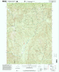
1996 Map of King Mountain
USGS Topo · Published 1999About this map
Quartzmill Peak and the high ridges of the Klamath Mountains dominate this 1990s survey, illustrating a landscape defined by resource extraction and modern infrastructure. Numerous prospects and specialized industrial sites like a Placer Mine and an Open Pit Mine are scattered across the terrain, reflecting the area's long history of mineral exploration. The presence of a Communication Tower and the King Mountain Communication Facility signifies the transition of these high peaks into strategic locations for regional telecommunications.
Find a feature on this map
38 named features on this map. Tap any name to fly to it.
Don’t see what you’re looking for? This feature index may not catch every label — zoom into the map to look around manually.
Map Details
Editions of this 1996 King Mountain Map
This is the sole edition of this map. No revisions or reprints were ever made.
Other maps of this area

1904 · Riddle
USGS Topo · 1:125,000

1954 · Days Creek
USGS Topo · 1:62,500

1954 · Glendale
USGS Topo · 1:62,500

1954 · Wimer
USGS Topo · 1:62,500

1954 · Canyonville
USGS Topo · 1:62,500

1955 · Medford
USGS Topo · 1:250,000

1957 · Medford
USGS Topo · 1:250,000

1958 · Medford
USGS Topo · 1:250,000
1983 · Wimer
USGS Topo · 1:24,000
1983 · Skeleton Mtn
USGS Topo · 1:24,000