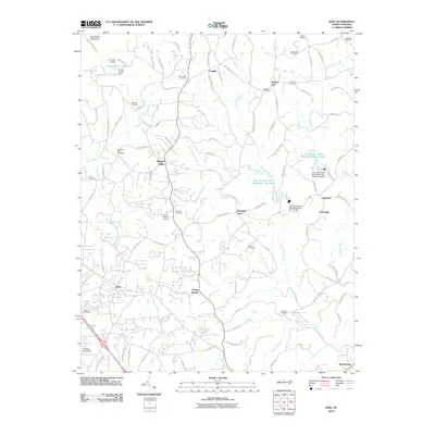
2010 Map of King
USGS Topo · Published 2010About this map
Sauratown Mountain anchors the northwest corner of this Stokes County landscape, where the terrain transitions from high ridges to the creek valleys that define local settlement. The 2010 geography shows a network of family-named cemeteries such as the Sizemore Cemetery and Tuttle Cemetery, which are scattered among small communities like Poplar Springs, Quaker Gap, and Mount Olive. This area is heavily defined by its water management, featuring several impoundments including the Town Fork Creek Watershed Lake Ten and Town Fork Creek Watershed Lake Sixteen. These reservoirs, along with the Camp Hanes Dam, reflect the modern rural infrastructure surrounding the city of King. Notable landmarks like the Cross Roads Airport and the sprawling grounds of Camp Hanes sit alongside the winding paths of Town Fork Creek and the East Prong Little Yadkin River, showing a region where recreation and local agriculture coexist.
Find a feature on this map
107 named features on this map. Tap any name to fly to it.
Don’t see what you’re looking for? This feature index may not catch every label — zoom into the map to look around manually.
Map Details
Editions of this 2010 King Map
This is the sole edition of this map. No revisions or reprints were ever made.
Other maps of this area

1951 · Rural Hall
USGS Topo · 1:24,000

1951 · Walkertown
USGS Topo · 1:24,000

1953 · Winston-Salem
USGS Topo · 1:250,000

1955 · Winston-Salem
USGS Topo · 1:250,000

1962 · Winston-Salem
USGS Topo · 1:250,000

1964 · Hanging Rock
USGS Topo · 1:24,000

1964 · Pinnacle
USGS Topo · 1:24,000

1964 · King
USGS Topo · 1:24,000

1964 · Pilot Mountain
USGS Topo · 1:24,000
1968 · Vienna
USGS Topo · 1:24,000