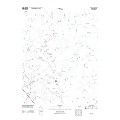
2013 Map of King
USGS Topo · Published 2013About this map
King serves as a primary hub of development in this North Carolina landscape, where the foothills meet a complex network of headwater streams. The topography is defined by the drainage of the E Prong Little Yadkin River and Town Fork Creek, which support a series of water management features including Town Fork Creek Watershed Lake Sixteen and Town Fork Creek Watershed Lake Ten. To the north, Camp Hanes and its namesake Camp Hanes Lake highlight the area's long-standing connection to outdoor recreation near the Sauratown Mountains.
Find a feature on this map
245 named features on this map. Tap any name to fly to it.
Don’t see what you’re looking for? This feature index may not catch every label — zoom into the map to look around manually.
Map Details
Editions of this 2013 King Map
This is the sole edition of this map. No revisions or reprints were ever made.
Other maps of this area

1951 · Rural Hall
USGS Topo · 1:24,000

1951 · Walkertown
USGS Topo · 1:24,000

1953 · Winston-Salem
USGS Topo · 1:250,000

1955 · Winston-Salem
USGS Topo · 1:250,000

1962 · Winston-Salem
USGS Topo · 1:250,000

1964 · Hanging Rock
USGS Topo · 1:24,000

1964 · Pinnacle
USGS Topo · 1:24,000

1964 · King
USGS Topo · 1:24,000

1964 · Pilot Mountain
USGS Topo · 1:24,000
1968 · Vienna
USGS Topo · 1:24,000