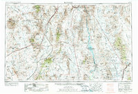
1954 Map of Kingman
USGS Topo · Published 1972About this map
Kingman sits at the nexus of the Atchison Topeka and Santa Fe railroad and U S 66, serving as a gateway to the high desert landscapes of northwestern Arizona and southern Nevada. This mid-century view captures the transition of the Colorado River basin following the construction of massive engineering works. The waters of Lake Mead National Recreation Area and Lake Mohave are shown held back by Hoover Dam and Davis Dam, forever altering the desert floor.
Find a feature on this map
77 named features on this map. Tap any name to fly to it.
Don’t see what you’re looking for? This feature index may not catch every label — zoom into the map to look around manually.
Map Details
Editions of this 1954 Kingman Map
4 editions found

Other maps of this area

1886 · Diamond Creek
USGS Topo · 1:250,000

1886 · Camp Mohave
USGS Topo · 1:250,000

1886 · Saint Thomas
USGS Topo · 1:250,000

1886 · Mt. Trumbull
USGS Topo · 1:250,000

1892 · Diamond Creek
USGS Topo · 1:250,000

1892 · Mt. Trumbull
USGS Topo · 1:250,000

1892 · Camp Mohave
USGS Topo · 1:250,000

1893 · Saint Thomas
USGS Topo · 1:250,000

1903 · Needles
USGS Topo · 1:125,000

1904 · Needles Special
USGS Topo · 1:125,000