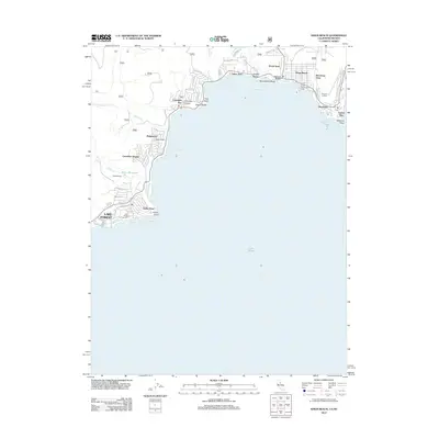
2012 Map of Kings Beach
USGS Topo · Published 2012About this map
Kings Beach and the surrounding north shore of Lake Tahoe appear in this 2012 survey as a corridor of recreational and residential development at the California-Nevada border. This area includes the distinct lakefront communities of Tahoe Vista, Brockway, and Carnelian Bay, where the shoreline is defined by points and coves like Flick Point and Agate Bay. The map provides a clear view of the transition from the lakeside settlements to the rising timberland above, marked by forest service roads such as 16n74 and 16n63. To the west, Lake Forest and the Lake Forest Campground sit near Dollar Point, indicating the seasonal tourism economy that has long shaped the region. Local infrastructure such as the Dollar Reservoir and the Tahoe Nordic center further illustrate the land use patterns focused on managing water resources and winter recreation along the Sierra Nevada slopes.
Find a feature on this map
54 named features on this map. Tap any name to fly to it.
Don’t see what you’re looking for? This feature index may not catch every label — zoom into the map to look around manually.
Map Details
Editions of this 2012 Kings Beach Map
This is the sole edition of this map. No revisions or reprints were ever made.
Other maps of this area

1891 · Carson
USGS Topo · 1:125,000

1891 · Truckee
USGS Topo · 1:125,000

1893 · Carson
USGS Topo · 1:125,000

1893 · Truckee
USGS Topo · 1:125,000

1895 · Truckee
USGS Topo · 1:125,000

1932 · Truckee
USGS Topo · 1:96,000

1940 · Truckee
USGS Topo · 1:125,000

1950 · Mt. Rose
USGS Topo · 1:62,500

1952 · Mt. Rose
USGS Topo · 1:62,500
1955 · Homewood
USGS Topo · 1:24,000