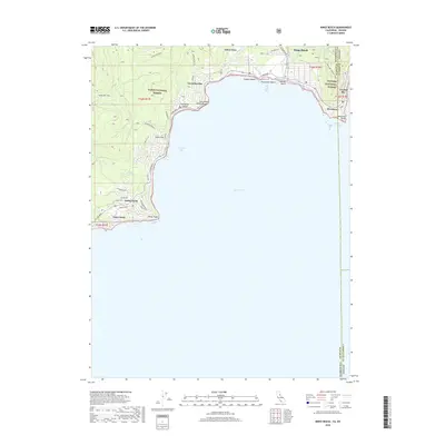
2018 Map of Kings Beach
USGS Topo · Published 2018About this map
Kings Beach and Tahoe Vista anchor the northern shoreline of Lake Tahoe, where the California-Nevada state line cuts through the community of Brockway. This 2018 survey details a landscape defined by its transition from waterfront settlements to the high elevations of Tahoe National Forest. The map traces the winding path of the Tahoe Rim Trail as it skirts the ridgeline above Carnelian Bay, offering a view of the intricate network of local roads such as N Lake Blvd and Shivagiri Rd. Coastal features including Flick Point, Dollar Point, and Stateline Point frame several recreational areas like Moondunes Beach and Secline Beach. Inland, the terrain is shaped by Watson Creek and Dollar Creek, while the Stateline Lookout Trail provides access to the heights near the Washoe County border.
Find a feature on this map
49 named features on this map. Tap any name to fly to it.
Don’t see what you’re looking for? This feature index may not catch every label — zoom into the map to look around manually.
Map Details
Editions of this 2018 Kings Beach Map
This is the sole edition of this map. No revisions or reprints were ever made.
Other maps of this area

1891 · Carson
USGS Topo · 1:125,000

1891 · Truckee
USGS Topo · 1:125,000

1893 · Carson
USGS Topo · 1:125,000

1893 · Truckee
USGS Topo · 1:125,000

1895 · Truckee
USGS Topo · 1:125,000

1932 · Truckee
USGS Topo · 1:96,000

1940 · Truckee
USGS Topo · 1:125,000

1950 · Mt. Rose
USGS Topo · 1:62,500

1952 · Mt. Rose
USGS Topo · 1:62,500
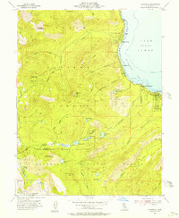
1955 · Homewood
USGS Topo · 1:24,000