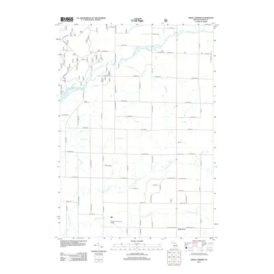
2012 Map of Kings Corners
USGS Topo · Published 2012About this map
Big Sable River and several branches of the Lincoln River define this Mason County landscape just inland from Lake Michigan. The map illustrates a transitional rural environment where agricultural land meets the forested corridors of Freeman Cr and Davis Cr. Small settlement points like Kings Corners and Sugar Grove provide historical anchors for the region, while the West Shore Community College campus represents a significant modern institutional presence in the south. For those tracing local heritage, the Grant Township Cem and North Victory Cem are clearly marked. The grid-like road system, featuring names such as Nurnberg Rd and W Fountain RD, shows the organized division of the township, while the northwestern corner touches the edge of Hamlin Lake.
Find a feature on this map
46 named features on this map. Tap any name to fly to it.
Don’t see what you’re looking for? This feature index may not catch every label — zoom into the map to look around manually.
Map Details
Editions of this 2012 Kings Corners Map
This is the sole edition of this map. No revisions or reprints were ever made.
Other maps of this area

1931 · Custer NW
USGS Topo · 1:31,680

1931 · Manistee SE
USGS Topo · 1:31,680

1931 · Freesoil SW
USGS Topo · 1:31,680

1931 · Manistee SW
USGS Topo · 1:31,680

1932 · Ludington NE
USGS Topo · 1:31,680

1932 · Ludington
USGS Topo · 1:31,680

1954 · Milwaukee
USGS Topo · 1:250,000

1954 · Manitowoc
USGS Topo · 1:250,000

1957 · Freesoil
USGS Topo · 1:62,500

1958 · Manitowoc
USGS Topo · 1:250,000