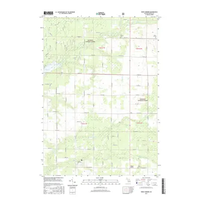
2017 Map of Kings Corners
USGS Topo · Published 2017About this map
Manistee National Forest covers much of this northern Mason County landscape, where the Big Sable River and Lincoln River systems carve through the glacial terrain. The map documents the rural character of Victory Township, anchored by the W Shore Community Coll campus and the small crossroads of Kings Corners and Sugar Grove. Genealogical interest is found in the scattered community cemeteries including North Victory Cem, Grant Township Cem, and Maple Grove Cem. The drainage patterns are intricate, with various creeks like Davis Cr and Dennis Cr feeding into the larger river basins. This 2017 edition illustrates a modern rural infrastructure defined by a grid of local roads such as W Fountain Rd and Nurnberg Rd, alongside the preserved forest lands that dominate the northeastern and central sections.
Find a feature on this map
65 named features on this map. Tap any name to fly to it.
Don’t see what you’re looking for? This feature index may not catch every label — zoom into the map to look around manually.
Map Details
Editions of this 2017 Kings Corners Map
This is the sole edition of this map. No revisions or reprints were ever made.
Other maps of this area

1931 · Custer NW
USGS Topo · 1:31,680

1931 · Manistee SE
USGS Topo · 1:31,680

1931 · Freesoil SW
USGS Topo · 1:31,680

1931 · Manistee SW
USGS Topo · 1:31,680

1932 · Ludington NE
USGS Topo · 1:31,680

1932 · Ludington
USGS Topo · 1:31,680

1954 · Milwaukee
USGS Topo · 1:250,000

1954 · Manitowoc
USGS Topo · 1:250,000

1957 · Freesoil
USGS Topo · 1:62,500

1958 · Manitowoc
USGS Topo · 1:250,000